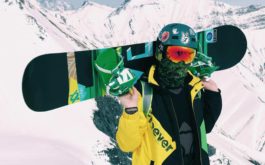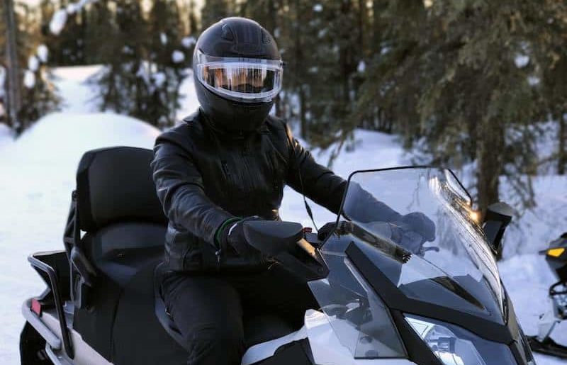
Snowmobiling is a fantastic way to see New York State and get outdoors during the winter months. New York offers over 10,500 miles of groomed and marked trails. They run from the Tug Hill region, across the Adirondacks and throughout western New York and the southern tier.
Many riders explore the backcountry to experience the snow-covered valleys and scenic vistas.
THE NEW YORK STATE SNOWMOBILE PROGRAM
New York State manages a snowmobile program as mandated from the Legislature. The Office of Parks, Recreation and Historic Preservation (OPRHP) is responsible for the trails. They plan the development, maintenance and oversight of a statewide snowmobile program.
The snowmobile trail system is statewide and runs for over 10,500 miles. It intersects 45 counties. The system is maintained by over 200 snowmobiling clubs across the state. It is funded by 51 municipal sponsors. The snowmobiling clubs are represented by the New York State Snowmobile Association (NYSSA). They act as an advocate for the clubs and sport.
The vast trail network crosses both public and private lands. It includes lands owned by:
- OPRHP
- New York State Department of Environment Conservation
- NYS Canal Corporation
as well as national forests, local authorities, and private landowners.
The state snowmobile program covers insurance for riders who are injured on private lands. This act as an incenture for landowners to open their property to the trails and riders.
Interactive trails map
The interactive trails map helps riders decide which trails they would like to ride.
The map now shows the 2017-18 state-funded snowmobile trails as provided by the NYS Office of Parks, Recreation, and Historic Preservation. It also shows the locations of the 200+ member snowmobile clubs, with links to their web pages. Trail intersections are also shown and labeled.
The Different Lands of New York State
The Adirondack and Catskill Forest Preserve consists of nearly 3 million acres of land. It provides marked trails to which snowmobiles are restricted. Forest Preserve lands offer amazing opportunities to experience a wide variety of trails. From seasonal motor vehicle trails to back country snowmobile trails which are generally more narroe than trails on private lands. These trails wind through hill and mountainous terrain in beautiful settings. Riders can easily use these route to move between communities and attractions.
Over 1,000 miles of snowmobile trails are located on 775,000 acres of State Forests. Some of these are part of the New York State Snowmobile Trail system. Others are State Forest Trail Systems which are more local in nature.
Snowmobiles are generally prohibited on Wildlife Management Areas. When it comes to Conservation Easements, snowmobiling varies from easement to easement. This is based on the rights the State was able to purchase from the private landowner. On most easements, public access is limited to designated trails only. However in some cases is further restricted during hunting season or prohibited entirely.
Get in touch with the snowmobiling clubs in the area you wish to ride to find out more about restrictions around Wildlife Management areas and Conservation Easements.
Where to Snowmobile in New York State
Brasher Falls
Near the St. Lawrence and Franklin county borders there is an impressive 57 miles of trails. The trails meander in and around Brasher State Forest. Half of St. Lawrence County is part of the Adirondack Park. The other half is part of the North Country, hugging the St. Lawrence Seaway, where this trail system sits. You can access the trails just north of Brasher Center entering at Meyers Road (just off County Route 53). Alternatively you can go to the end of Meyers Road at County Route 55 and start from there to get to the Deer River Trail System.
Thousand Islands Region
The snowmobile trail in the Thousand Islands Region does a loop that includes Clayton, Chaumont, Cape Vincent, Depauville. There are plenty of places to park your trailer and road vehicle and ride the trails: Clayton Recreation Park, Lynn’s Small Signs in Chaumont, Community Hall in Chaumont, and Sand Bay Inn in Cape Vincent. For a longer trip, head north along the St. Lawrence River valley along Thousand Islands State Park, and Wellesley Island State Park.
Lowville
The Lowville area sites at the edge of the Adirondacks, and in the middle of Lewis County. There are 72 miles of trails, which includes private land and public roads. Park-and-ride locations are at the Lowville Plaza, and at the local snowmobile club groomer barn on Rector Road. An excellent adjacent group of trails are location just west of Lowville at Barnes Corners. Barnes Corners is located just over the Jefferson County line into Lewis County.
Rivergate Trail
This Jefferson County Trail is around 30 miles in length and offers riding opportunities for all levels of rider. It consists of several small bridges, woods and meadows, a pond and river, a few small hills but largely straight terrain and spectacular views. This former railroad bed, also known as the Sissy Danforth Rivergate Trail, is now maintained by several ATV clubs. You can enter the system in Philadelphia, on Fort Drum’s western edge, and ride west to Theresa, then north to Redwood. A section of the trail also goes to Clayton, but check for signs that it’s open.
Snowmobiling in the Adirondacks
Tug Hill and Old Forge
Tug Hill is an upland region in Upstate New York in the United States, famous for heavy winter snows. The Tug Hill region is east of Lake Ontario, north of Oneida Lake, and west of the Adirondack Mountains. The region is separated from the Adirondacks by the Black River Valley.
The region has traditionally been known as the Tug Hill plateau because its top is flat. However it is not a plateau, but rather a cuesta, and composed of sedimentary rocks that tip up on one side. The rocks rise from about 350 feet (110 m) on the west to over 2,000 feet (610 m) in the east.
Old Forge is located near Tug Hill and regularly accumulates 300 inches of snow per year. This makes it a safe bet for good trail conditions. There are plenty of places to rest up, gas up, and fill up. Old Forge happily gives up its summer tourist season to make room for winter. In the greater Old Forge area alone, there are more than 500 miles of trails. Furthermore, many town streets are open to snowmobiles.
Cranberry Lake and Tupper Lake
This area, in Franklin County, is ripe with some of the most remote — and uncrowded — trails in the Adirondack system. Another bonus: most trails stay open through March, because winter tends to stick around. Cranberry Lake has two sections of trails totaling 9.4 miles, with various connections to other trails. A separate 2.6-mile trail allows snowmobilers to travel between Wanakena and Star Lake (add the Moores Trail to create a loop). For a longer route, take the Burntbridge Pond Trail from a parking lot on State Route 3. Cranberry is also part of a larger 500-mile trail system that includes South Colton, and Brasher State Forest.
To the north of Cranberry Lake, the Tupper Lake system boasts its position in the middle of the heavily traveled Corridor 7, with trails through the Ten Rivers Region, and no shortage of accommodations and restaurants along the way. The trail heads north to Malone in the Adirondack park’s northernmost corners, and has connections to several southbound and eastbound trails.
Tupper Lake boasts some of the best snowmobiling trails in the region and for good reason. Corridor 7, also known as the Remsen/Lake Placid New York Central Line is fantastically groomed and spacious enough for your group. Glide through vast landscapes of farms and forests and enjoy the state’s heaviest snowfalls in the Tug Hill region. You will find many amenities along the route for added convenience.
Speculator
Lakes and mountains await snowmobilers on these 650 miles of trails in the Speculator area. Part of the hugely traveled Hamilton County trail system (part of the largest in the state), Speculator is at the northeast tip of Lake Pleasant, and directly east of Old Forge.
Blue Mountain Lake
For a great day trip, take the 110-mile Blue Mountain Lake loop through Long Lake, Racquette Lake, Inlet and the Moose River Plains and back to Blue Mountain Lake. This is one of the newer trails in the state system, and there are plenty of places to stop and refuel your sled and your stomach along the way; Blue Mountain Lake knows how to cater to snowmobile riders. For more adventure, take any of the side trails to hundreds more miles of trails, including those that head south to Lake Pleasant/Speculator, or further to Old Forge.
The Moose River Plains
Located in the town of Inlet, this is a major hub on the Adirondack region’s Hamilton County to the west. Access this trail system, completed in 2013, on State Route 28 in Inlet. State-operated gates, 16 miles apart, mark the two main entrances to this trail. It is part of a 34-mile state corridor linking nearby Indian Lake.
Snowmobiling in the Catskills
Catskill Forest Preserve/Delaware County
The busiest snowmobiling destination in the Catskills, the mountains of this region have the makings of perfect riding: snow, scenery and well-maintained trails. About 350 miles of trails include the state’s C2 trail, a major corridor that dissects two state parks: Campbell Mountain Cherry Ridge and Bear Spring Mountain Wildlife Management Area. A 23-mile stretch of trails in south-central Delaware County round out the offerings to snowmobile riders.
Schoharie County/Utsayantha Trail
Some of the 100 or so miles of trails are through private land, with permission from landowners. Trails are marked with an Indian head logo. Twenty-five miles of groomed, well-maintained trails are in “Utsayantha Country,” the area surrounding and including Mount Utsayantha. Just southeast of Stamford village, Mount Utsayantha is a popular hiking spot, featuring a modest 700-foot elevation (complete with fire tower views) and fabulous 2-mile hiking trail. The scenery isn’t lost on snowmobilers, who enjoy extensions of the trail and unsurpassed access to the area’s winter vistas.
Headwaters Trails
Located in northwestern Catskills near the Bald Mountain Recreation Area, these 30 miles of trails are open to the public. Named for the headwaters of the Delaware River’s West branch, there are several marked trailheads. The nearby historic village of Stamford, considered the heart of snowmobiling in this region, is perfectly situated to provide food and amenities. Trails, on the former Delaware & Ulster Railroad bed, are maintained by local snowmobile groups, and are a cooperative public and private trail system.
Catskill Scenic Trail
Nearly 26 miles of groomed trails are located on this former rail bed adjacent to the Headwaters Trails. The main trail has access points that include Grand Gorge, South Gilboa, Stamford, Hobart, South Kortright and Bloomville. Another seven-mile extension was added to the eastern end of the trail, leading to south of Grand Gorge. The trails are owned and maintained by a non-profit organization, the Catskills Revitalization Corporation. The Delaware River can be seen from several areas along the trail, which is used on the off-season by bicyclists and hikers.
Willowemoc Wild Forest Preserve
The trailhead in Willowemoc provides access to more than 29 miles of trails including Long Pond and Mongaup Pond in the Catskills’ southwestern section. Here, northern Sullivan County and adjacent Ulster County share a welcome mat for snowmobile enthusiasts. The Willowemoc preserve has 14,800 acres, is home to several ponds and modest hills. Dog sledding is another popular winter activity here. The Sullivan County Trail Association and DEC work together to maintain the system.